
Spartylas
- Corfu Villages
-
Oct 28
-
9 min read
- Share post
Northeast Corfu · Mountain Villages
Spartylas, Corfu: The Window on Corfu Below Mount Pantokrator
Village guide: history, views, churches, the hike to Pantokrator and how to get there.
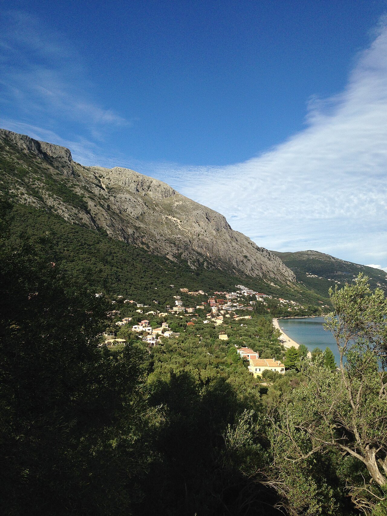
Spartylas (Greek: Σπαρτύλας, often written Spartilas) is a mountain village on the southern slopes of Mount Pantokrator, about 22 km north of Corfu Town. Perched at roughly 370 to 400 metres, with houses that seem to hang over the slope, it looks across the whole bay of Ypsos, Dassia and Corfu Town towards the mainland. Locals and long-time visitors call it the window on Corfu, and the name is earned.
Most people drive past on the coast road below without knowing it exists. That makes Spartylas one of the most rewarding detours on the island: a working mountain village with medieval lanes, old marble staircases, a Corfu Trail stop and the classic starting point for walking up to the island’s highest peak. This guide explains its setting, history, what to see and how to plan a visit.
Spartylas at a Glance
| Fact | Details |
|---|---|
| Name | Spartylas (Σπαρτύλας), also spelled Spartilas |
| Location | Southern slopes of Mount Pantokrator, northeast Corfu |
| Altitude | About 370 to 400 m |
| Distance from Corfu Town | About 22 km, around 40 minutes by car |
| Administration | Municipal unit of Faiakes, Municipality of Central Corfu and Diapontia Islands |
| Population (2021 census) | 762 for the community, which includes Barbati and Pyrgi |
| Known as | The window on Corfu, for its views |
| Walking | Stop on the Corfu Trail and starting point for Pantokrator |
| Nearest beaches | Barbati, Pyrgi and Ypsos, a short drive below |
A Village on the Shoulder of Pantokrator
Spartylas sits on a south-facing shelf of Pantokrator, the 906 m mountain that dominates the northeast of the island. The position gives the village two advantages that shaped its history: a mild, sunny climate on a mountain otherwise exposed to winter weather, and a view that covers every approach from the sea. On the bend just before the village, the panorama opens onto Dassia, the islet of Gerekou, Corfu Town and Vidos, and on clear days the view reaches as far as Paxos.
Like the other villages of Pantokrator, Spartylas grew on the mountain rather than the coast for good reasons. Inland and higher up, it was safer from pirates and from the malaria of the coastal lowlands, and the surrounding slopes supported olives, vines and livestock. Old threshing floors, stone cisterns and dry stone walls still mark the hillsides around the village.
History of Spartylas
Spartylas is described locally as a traditional medieval village, and its fabric supports that: narrow lanes made for donkeys rather than cars, marble staircases leading up to arched gateways, a Venetian-era chimney and old millstones from olive presses. Life here was tied to the mountain, and to Pantokrator itself. The monastery on the summit was founded in 1347 by the inhabitants of 23 surrounding villages, destroyed around 1537 and rebuilt in the late 17th century, and the villages of the slopes have climbed to it on pilgrimage for centuries.
In the 20th century Spartylas followed the pattern of most Corfiot mountain villages. As piracy and malaria disappeared and tourism created work on the coast at Ypsos, Pyrgi and Barbati, many families moved down. Unlike Old Perithia, though, Spartylas never emptied. It remains the administrative seat of a community that now includes the beach villages below, which says a lot about how the mountain and the coast have traded places in importance. The village is also the birthplace of Agis Stinas, a notable figure of the Greek labour movement, born here in 1900.
Exploring the Village
The village rewards a slow walk. Lime-washed walls in soft natural tints, flowers spilling from balconies and old vines over the lanes make it one of the most photogenic villages in the northeast. The church of Agios Arsenios stands at the highest point of the village with a view over the bay, while the church of Panagia has a spring of fresh water, one of many in a village known for its water sources. A traditional coffee shop, a taverna and a small supermarket keep daily life going, and a few houses have been restored by foreign residents who settled here for the views and the quiet.
- The viewpoint bend. Just before the village, with a sweeping view over Ypsos Bay, Dassia, Corfu Town and Vidos.
- Agios Arsenios. The church at the top of the village, with one of the best views in Spartylas.
- Panagia church and spring. A small church with its own source of fresh mountain water.
- Marble staircases and gateways. Traditional entrances that survive throughout the old lanes.
- Rural heritage. A Venetian-era chimney, olive millstones, threshing floors and stone cisterns.
- The Corfu Trail. The long-distance path passes through the village on its way towards Pantokrator.
The View: What You See From Spartylas
| What you can see | Where it is | Notes |
|---|---|---|
| Ypsos Bay | Directly below to the south | One of the longest beaches on the east coast |
| Dassia | Southwest along the coast | Resort area on the bay |
| Gerekou islet | In the bay off Gouvia | Small islet in the channel |
| Corfu Town and Vidos | To the south | The Old Town skyline and the islet in front of the port |
| Paxos | Far to the south | Visible only on very clear days |
| Mount Pantokrator | Directly above | Summit monastery at 906 m |
Walking From Spartylas to Mount Pantokrator
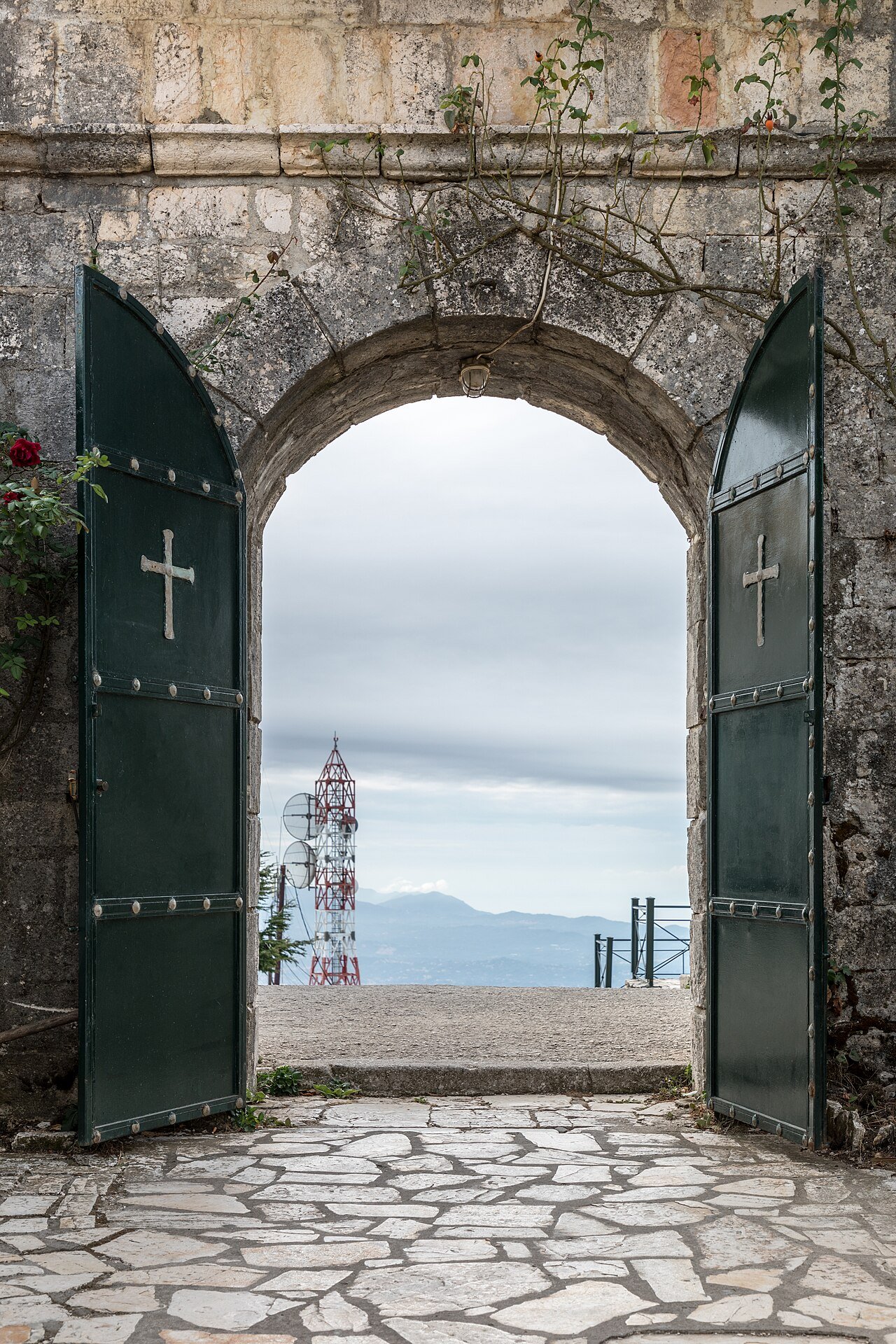
Spartylas is one of the classic bases for walking on Pantokrator. The Corfu Trail, the long-distance route of about 200 km that crosses the island from south to north, passes through the village, and from here the paths climb into open mountain terrain towards the summit. From the village the climb to the top is over 500 metres of ascent, so plan a half-day round trip, start early in summer and carry water, as shade is limited higher up. At the top stands the monastery of the Transfiguration, rebuilt around 1689, next to the island’s telecommunications masts. On a clear day you can see the whole of Corfu, the coast of Albania and sometimes even Italy.
On 6 August, the feast of the Transfiguration, the monastery hosts the biggest religious festival on the island, and local villagers traditionally walk up through the night carrying candles and torches.
How to Get to Spartylas
From Corfu Town, take the coast road north towards Kassiopi. Past Ypsos and Pyrgi, a signposted road turns uphill to Spartylas; it is about 4 km of narrow, winding hairpins to the edge of the village and a little more to the centre. Drive slowly and use your horn on blind bends. Parking in the village is limited, so leave the car where signs allow and explore on foot. Buses run along the coast road, but the climb up is best done by car, taxi or on foot for experienced walkers.
Best Time to Visit and Practical Tips
Spring and autumn are ideal: the mountain is green or golden, the air is clear and walking is comfortable. In summer, visit in the morning for walks or in the evening for dinner with a view, and combine it with a swim at Barbati or Ypsos. Thanks to its south-facing position, Spartylas is also pleasant in winter, when the view across the bay is often at its sharpest.
- Drive the access road in daylight the first time; the hairpins are tight.
- Pair the village with a swim at Barbati or Pyrgi below.
- For the summit hike, start early, carry plenty of water and wear proper boots.
- Go on 6 August only if you want the festival atmosphere; expect crowds on the mountain.
- Stop at the bend before the village for the classic photo over Ypsos Bay.
Is Spartylas Worth Visiting?
Yes, especially if you want to see a Corfu village that is still lived in rather than staged. Spartylas does not have a famous monument or a single postcard sight. Its value is the combination of an authentic mountain village, one of the widest views on the island and direct access to Pantokrator, all within 40 minutes of Corfu Town and a few minutes above the east coast beaches. For travellers who mostly know Corfu from the coast, it offers a completely different perspective in every sense.
Spartylas FAQ
Where is Spartylas in Corfu?
Spartylas is on the southern slopes of Mount Pantokrator in northeast Corfu, about 22 km north of Corfu Town, above Pyrgi, Ypsos and Barbati.
Is it spelled Spartylas or Spartilas?
Both spellings are used for the same village. The Greek name is Σπαρτύλας; official sources usually write Spartylas, while many travel sites use Spartilas.
Why is Spartylas called the window on Corfu?
Because of its view. From the village you can see the whole bay of Ypsos, Dassia, Corfu Town and Vidos, and on very clear days as far as Paxos.
How high is Spartylas?
The village lies at roughly 370 to 400 metres above sea level, on a south-facing slope below the 906 m summit of Pantokrator.
Can you walk from Spartylas to Mount Pantokrator?
Yes. Spartylas is on the Corfu Trail and is a classic starting point for the summit. Expect more than 500 m of ascent and allow a half day for the round trip.
How do you get to Spartylas?
Drive north from Corfu Town on the coast road towards Kassiopi and take the signed turn uphill after Pyrgi. The final 4 km are narrow hairpin bends.
Are there tavernas in Spartylas?
Yes. The village has a taverna, a traditional coffee shop and a small supermarket, and more restaurants can be found on the coast below.
What is the Pantokrator festival?
On 6 August the monastery on the summit celebrates the Transfiguration. It is the largest religious festival on Corfu, and villagers traditionally climb up through the night with candles.
How many people live in Spartylas?
The 2021 census counted 762 people in the community of Spartylas, which also includes the coastal villages of Barbati and Pyrgi.
Sources: Wikipedia (Spartylas, Mount Pantokrator, 2021 census), local Corfu history and travel sources. Photos via Wikimedia Commons under free licences; authors credited on each file page. Facilities and road conditions change; confirm locally.